 |
Location: The highest point in the Eastern United States, at an Elevation of 6684 ft., Mt. Mitchell is located Northeast of Asheville, N.C. and can be accessed off the Blue ridge Parkway or hiked to from a number of vantage points. | |
 |
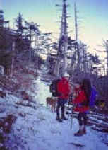
We chose a route from the Northeast off a forestry road where we started to encounter the shelving of the trail path resembling a long series of monument steps that continued all the way to the summit. As we neared the cresting of a ridge we emerged from the Rhododendrons into intense growths of Hemlock trees and snow. The weather instantly changed with the elevation and leaving the protection of the Rhododendrons. The trail now resembled walking through a Christmas tree farm. As we emerged from the Hemlock trees we were informed by our suspicious guide that the dying trees we were now encountering were caused by different types of pollution that has ravaged the area. Although depressing, it provided quite a contrast to the varying plush landscape that was protected by the valleys. |
|
| With the terrain change we knew we were close to the summit. We needed to get past the public area at the summit and continue down the ridge out to the highest point and then beyond to set up camp for the evening. |
|
|
|
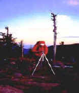
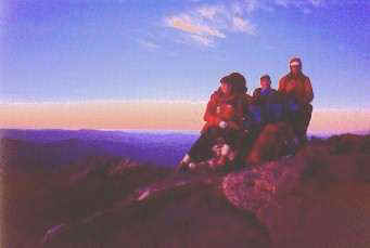
Upon reaching the summit we quickly set up camera equipment to record the event and take the opportunity to shoot the unusually clear sky for this region. At this point Stacey took advantage of the light and shot a number of portfolio shots while Stuart captured the details of different areas for possible future painting compositions back in the studio. The temperature was dropping very quickly as we raced the diminishing light. | |
| We knew it would be a fair distance before we could camp because of the forest regulations on camping locations. As we hiked down the ridge we encountered heavy rock formations covered in ice. An hour later we were in darkness with only headlamps to guide us over the rough and narrow ridge. After over two hours of scrambling down this ridge we found a flat area to set up our tent and spend the night. With the temperature dropping we made a decision to camp at this location and get in our shelter up on the ridge rather than risking the hike down in the dark and possibly not finding another camp site for a while. The temperature dropped to 5 degrees with very strong winds. | ||
|
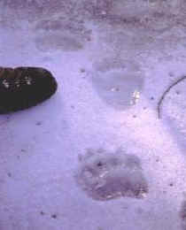
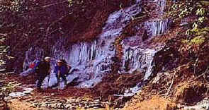
The next day we proceeded down off the ridge and on our way back to our vehicle. Part of the trail runs along the face of a hill on an old logging road bordered by heavy brush above and below. This is where a little excitement was provided with the discovery of fresh bear tracks made that morning in the snow. The photograph shows a size 14 hiking boot next to the tracks. Enough bear to make us think about avoiding. The problem was the tracks were going in our same direction of travel and we knew that the icy surface was made the night before. We had no other trail to deviate to so we just hoped the bear had made these tracks very early that morning and was done with its chores for that day. More opportunities arose on this portion of the hike for photography as waterfalls had turned to ice overnight. |
|
|
|
|
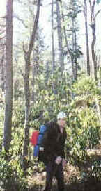
| To top off the adventure we hiked
through an area of "virgin" timber. An area that had never been logged. It felt
a little like a prehistoric world. A number of images were collected in this area for
future compositions by Stuart. We hope you venture to this area of the country and experience the diversity in the landscape. Please continually check in for new Expeditions. |
||